
Be sure to enjoy these trails in RJ at the end of the year
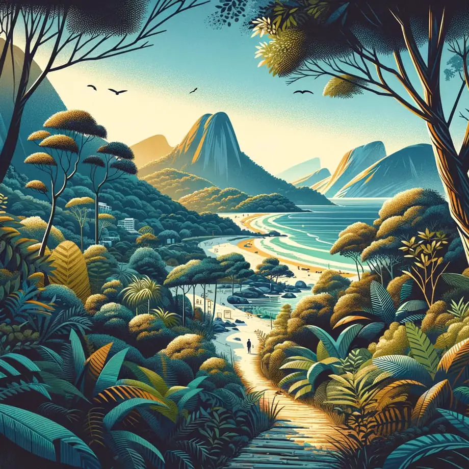
Trekkers on duty, it is the end of the year and, therefore, the time is now: water bottle, cap and backpack on the back because it is time to relax from the months of work seeing the Marvelous City from above. Rio de Janeiro offers a large number of trails at different levels and I have already made a very long list with the best options in another post.
very long list with the best optionsIf you like challenges or just want to have fun with your family, all you have to do is choose your itinerary, prepare your camera and literally hit the road. Of course, don't forget that very comfortable sneakers, light clothes, sunscreen and looking for an experienced guide (or a friend who already knows the way well) on the trails in Rio.
If you are from outside of RJ, don't forget to book your stay to rest - the vacation rental in Rio de Janeiro is a new option that caters for all tastes, from the most economical to the one that is willing to spend more. I'm sure you will love the adrenaline rush to reach the top and the feeling of overcoming that accompanies each achievement. Ready for the challenge? Discover some of the main trails in Rio and choose your program!
vacation rental in Rio de JaneiroPedra da Gávea (Heavy Level, with natural obstacles)
This is for those who already have some experience or are really up for challenges: loved by some and feared by others, the trail of the impressive Pedra da Gávea has basically two paths. One of them is not difficult - up to the point of Carrasqueira. There are people who stop there and never reached the top, can you do it? Access is at the end of Estrada do Sorimã, in Barrinha, and is long, taking about 2 hours of walking.
In the first 40 minutes, you have to breathe, but then it gets worse, getting steeper and slipperier because of small waterfalls, until a mind-boggling precipice and a stone wall appear: here is the dreaded Carrasqueira, with 30 meters of water. height. At this point, it is necessary to do a 1st degree climb. Then there's still a lot of walking. It is worth taking great care, since there is a risk of death, so if you are not comfortable, it is better to accept being one of those who come back halfway.
The second path is even more difficult (via Pico dos 4), although it only takes Carrasqueira on the way down - but on the way up there are stretches with height exposure and two flights with steel cable. Brabeira that is worthwhile: wherever you go, the view from up there is chilling, after all you are 842 meters high in the largest block of stone by the sea on the planet. Not to mention the mysteries that surround the stone and the basic stories of flying saucers, the tomb of Phoenician kings and so on. Go?
If you find this option too heavy for you, the Pedra Bonita trail reserves an equally beautiful view and with a lower level of difficulty.
Pedra Bonita trailMorro Dois Irmãos (Moderate Level)
In another post I have already written all the details of the Morro Dois Irmãos trail. The view from there is one of the most well-known postcards in Rio, and is also one of the most popular trails. It is only a 40 minute moderate walk, and from up there you can see all of São Conrado with Pedra da Gávea on one side and, on the other, Cristo Redentor to the waters of Leblon Beach. You access the trail through the entrance to Vidigal, in São Conrado, and from there take the circular transport that takes you to the football field of Vila Olímpica, where the trail started. If you did not take a snack this is the chance to stock up on some of the snack bars that are around there.
Morro Dois Irmãos trailThe top is 1.5 km uphill, from where you can have very interesting images of Rocinha, and its privileged view of São Conrado Beach, one of the most beautiful in Rio - but it is from up there that the view is really stunning : they are 360º of a panorama that includes Vidigal, Rocinha, Tijuca Forest, Lagoa, Ipanema, Leblon, Cagarras Islands and Cristo Redentor. Breathtaking. On the way back, the request is a dip in the waters of São Conrado.
Costão de Itacoatiara (Moderate Level)
Every year Itacoatiara, in the Oceanic Region of Niterói, establishes itself as the darling of Rio's beaches and has already earned the affectionate nickname on the social networks of #itacoatiaradise. In addition to the beautiful view, the cleanest water among the urban beaches of Rio and the waves suitable for surfing, the neighborhood has one of the most beautiful trails as well. Access is via the entrance to the Serra da Tiririca State Park, managed by Inea and you enter through Rua das Rosas, in the left corner of the neighborhood. Itacoatiara is about 30 minutes from the Center of Niterói and there are no buses, only cars - but as the neighborhood is tiny, it is easy to jump on Estrada Francisco da Cruz Nunes and walk.
I already spoke in another post about Costão's trail, but let's get to the point. The beginning of the trail is closed forest, but well signposted and with a lot of movement - there is always someone going up or down. About 10 minutes later you arrive at a kind of patio, with a wooden bench and everything to help you make your decision: one of the bifurcations goes to Costão, another to Enseada do Bananal (a path between the rocks that ends in a cove minimal and very blue) and the other to Pedra do Elefante (a longer trail that ends in Itaipuaçu, already in the municipality of Maricá).
Costão trailBut be careful: to climb the Costão, actually a big rock that ends on the beach, it is better to go with your own sneakers so you don't slip. The view from up there is fantastic, you can see the whole Itacoatiara Beach with its transparent waters, the Christ the Redeemer, Pedra da Gávea and Pão de Açúcar. In total they are 2 km long and about 30 minutes to go and another 30 to return. The tip is to go early and spend the whole day there: after descending the dive is irresistible and, at the end of the afternoon, enjoy the sound that goes live with tasty drinks and snacks at the waterfront kiosks.
Pico da Tijuca (Moderate Level) and Beak of the Parrot (Moderate Level)
Access is through the Tijuca Forest, and you can drive to the base of the trail, in Bom Retiro, but on foot, from Pracinha do Alto da Boa Vista (Afonso Vizeu) until there the route takes about 1 hour. The beginning of the trail is the same that goes to Bico do Papagaio and goes smoothly until a bifurcation - that you should take to the right (to the left it is in Bico do Papagaio), and then go in a zig-zag marreading the northeast slope until a staircase leading to the top, 685 meters above sea level. From there the view is also fantastic: in 360º you can see the Maracanã, Engenhão, Rio-Niterói Bridge, Rodrigo de Freitas Lagoon and Cristo Redentor.
After Pico da Tijuca, the second most popular trail is Bico do Papagaio, which is about the same height. The start of the trail is the same, but you must turn left at the fork. Well marked and shaded, it goes easy until the new fork, in the lap, where it is necessary to go to the right - and it is now that the degree of difficulty increases, becoming quite steep, having to use roots and trunks to raise the body and move forward . In some places clamps already placed facilitate the passage. But it's worth it: between one piece and another, small viewpoints reveal incredible landscapes, until you reach the top. There are other trails to reach the same place, but this is the most used. On the way back, the restaurants of Floresta and Pracinha await you with tasty dishes to replenish your energy!
Açude do Camorim (Moderate Level)
The walk begins at the Cedae treatment station, which is responsible for treating the water supplied in the weir, which is uphill. Throughout the route it is possible to appreciate different species of the remaining flora of the Atlantic Forest. If the trail is done in the morning, very early, or at night, it is possible to appreciate some animals such as armadillo, paca and coati as well.
After 1 hour of trekking, the sound of the birds merges with those of Cachoeira do Camorim. After the almost mandatory break at the waterfall to cool off, the trail continues a little easier, because the terrain is flat in this part. Bathing in the reservoir is not allowed, as the waters are used to supply a good part of Jacarepaguá, and because there are many stories of disappearances in these waters.
The total route is about 4 km, full of animals and flowers, and the result is a stunning view of the Weir, located at more than 436 m above sea level (higher than the Sugarloaf Mountain).
Choose your itinerary, put your backpack on your back and enjoy the best trails in Rio de JaneiroFrequently Asked Questions
- What seasonal advantages do these trails in Rio de Janeiro offer at the end of the year, and are there any special preparations needed?
- At the end of the year, these trails often offer cooler weather and clearer skies, making hiking more enjoyable. Special preparations might include checking trail conditions post-rainy season and being mindful of holiday crowds.